Vancouver to Terrace Flight Time, Distance, Route Map
Flight time from Vancouver, Canada to Terrace, Canada is 0 hours 51 minutes under avarage conditions. Our flight time calculator assumes an average flight speed for a commercial airliner of 500 mph, which is equivalent to 805 km/hr or 434 knots. Actual flight times may vary depending on aircraft type, cruise speed, routing, weather conditions, passenger load, and other factors.
What is the Flight Distance Between Vancouver and Terrace?
The flight distance from Vancouver (Canada) to Terrace (Canada) is 431 miles. This is equivalent to 693 kilometers or 374 nautical miles. The calculated distance (air line) is the straight line distance or direct flight distance between cities. The nearest airport to Vancouver, is Vancouver International Airport (YVR) and the nearest airport to Terrace, is Terrace Airport (YXT).
Vancouver - Terrace Timezones & Time Difference
Current local time in Vancouver is 2025-09-18, 16:04:43 PDT
Current local time in Terrace is 2025-09-18, 16:04:43 MST.
Time difference between Vancouver (Canada) and Terrace (Canada) is 0 Hours.
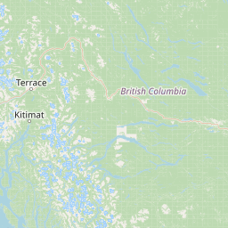
Vancouver to Terrace Flight Route Map
Flight map from Vancouver, Canada to Terrace, Canada is given below.Click the map to view Vancouver to Terrace nonstop flight path and travel direction.
             Leaflet | © OpenStreetMap The distance between cities calculated based on their latitudes and longitudes. This is also called distance as the crow flies. Bird flight distance is calculated by drawing a straight line between two point coordinates. The length of this drawn line will give the shortest distance value. This distance may be very much different from the actual travel distance. Vancouver GPS Coordinates: Latitude: N 49° 16' 57.8'' Longitude: W 123° 7' 14.7'' Terrace GPS Coordinates: Latitude: N 54° 31' 5.5'' Longitude: W 128° 36' 11.4'' Vancouver Map, Where is Vancouver located? Terrace Map, Where is Terrace located? |
Popular Searches from Vancouver
- Vancouver to Montreal flight time, duration and distance
- Vancouver to Dubai flight time, duration and distance
- Vancouver to Hong Kong flight time, duration and distance
- Vancouver to Ketchikan flight time, duration and distance
- Vancouver to Honolulu flight time, duration and distance
- Vancouver to Montreal flight time, duration and distance
- Vancouver to Tokyo flight time, duration and distance
- Vancouver to Honolulu flight time, duration and distance
- Vancouver to Toronto flight time, duration and distance
- Vancouver to Santiago flight time, duration and distance
- Vancouver to Cabo San Lucas flight time, duration and distance
- Vancouver to Guangzhou flight time, duration and distance
- Vancouver to Narita flight time, duration and distance
- Vancouver to Tokyo flight time, duration and distance
- Vancouver to Yakumo flight time, duration and distance
- Vancouver to Victoria flight time, duration and distance
- Vancouver to Nanaimo flight time, duration and distance
- Vancouver to Bangkok flight time, duration and distance
- Vancouver to Tampa flight time, duration and distance
- Vancouver to Madrid flight time, duration and distance