Sydney to Kochi Flight Time, Distance, Route Map
Flight time from Sydney, Australia to Kochi, India is 11 hours 31 minutes under avarage conditions. Our flight time calculator assumes an average flight speed for a commercial airliner of 500 mph, which is equivalent to 805 km/hr or 434 knots. Actual flight times may vary depending on aircraft type, cruise speed, routing, weather conditions, passenger load, and other factors.
What is the Flight Distance Between Sydney and Kochi?
The flight distance from Sydney (Australia) to Kochi (India) is 5757 miles. This is equivalent to 9264 kilometers or 4999 nautical miles. The calculated distance (air line) is the straight line distance or direct flight distance between cities. The nearest airport to Sydney, is Kingsford Smith Airport (SYD) and the nearest airport to Kochi, is Kochi Airport (COK).
Sydney - Kochi Timezones & Time Difference
Current local time in Sydney is 2025-08-13, 21:52:24 AEST
Current local time in Kochi is 2025-08-13, 17:22:24 IST.
Time difference between Sydney (Australia) and Kochi (India) is 4 Hours 30 Minutes.
Kochi time is 4 Hours 30 Minutes behind Sydney.
Sydney to Kochi Flight Route Map
Flight map from Sydney, Australia to Kochi, India is given below.Click the map to view Sydney to Kochi nonstop flight path and travel direction.
   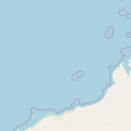    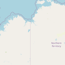                 Leaflet | © OpenStreetMap The distance between cities calculated based on their latitudes and longitudes. This is also called distance as the crow flies. Bird flight distance is calculated by drawing a straight line between two point coordinates. The length of this drawn line will give the shortest distance value. This distance may be very much different from the actual travel distance. Sydney GPS Coordinates: Latitude: S 33° 52' 2.9'' Longitude: E 151° 12' 25.1'' Kochi GPS Coordinates: Latitude: N 9° 55' 52.4'' Longitude: E 76° 16' 2.3'' Sydney Map, Where is Sydney located? Kochi Map, Where is Kochi located? |
Popular Searches from Sydney
- Sydney to Hobart flight time, duration and distance
- Sydney to Auckland flight time, duration and distance
- Sydney to San Francisco flight time, duration and distance
- Sydney to Johannesburg flight time, duration and distance
- Sydney to Barcelona flight time, duration and distance
- Sydney to Chennai flight time, duration and distance
- Sydney to New Zealand flight time, duration and distance
- Sydney to Vancouver flight time, duration and distance
- Sydney to Manila flight time, duration and distance
- Sydney to Singapore flight time, duration and distance
- Sydney to London flight time, duration and distance
- Sydney to Istanbul flight time, duration and distance
- Sydney to Mexico City flight time, duration and distance
- Sydney to Hong Kong flight time, duration and distance
- Sydney to Los Angeles flight time, duration and distance
- Sydney to Singapore flight time, duration and distance
- Sydney to Hong Kong flight time, duration and distance
- Sydney to New York flight time, duration and distance
- Sydney to London flight time, duration and distance
- Sydney to Fairbanks flight time, duration and distance
Popular Searches from Kochi
- Kochi to Mumbai flight time, duration and distance
- Kochi to Mumbai flight time, duration and distance
- Kochi to San Francisco flight time, duration and distance
- Kochi to Doha flight time, duration and distance
- Kochi to Dubai flight time, duration and distance
- Kochi to New Delhi flight time, duration and distance
- Kochi to Cairo flight time, duration and distance
- Kochi to Nairobi flight time, duration and distance
- Kochi to Addis Ababa flight time, duration and distance
- Kochi to Kolkata flight time, duration and distance
- Kochi to Mumbai flight time, duration and distance
- Kochi to Colombo flight time, duration and distance
- Kochi to Dar es Salaam flight time, duration and distance
- Kochi to Chennai flight time, duration and distance
- Kochi to Singapore flight time, duration and distance
- Kochi to Tehran flight time, duration and distance
- Kochi to Singapore flight time, duration and distance
- Kochi to Dubai flight time, duration and distance
- Kochi to Delhi flight time, duration and distance