Salt Lake City to Helena Flight Time, Distance, Route Map
Flight time from Salt Lake City, United States to Helena, United States is 0 hours 48 minutes under avarage conditions. Our flight time calculator assumes an average flight speed for a commercial airliner of 500 mph, which is equivalent to 805 km/hr or 434 knots. Actual flight times may vary depending on aircraft type, cruise speed, routing, weather conditions, passenger load, and other factors.
What is the Flight Distance Between Salt Lake City and Helena?
The flight distance from Salt Lake City (United States) to Helena (United States) is 403 miles. This is equivalent to 649 kilometers or 350 nautical miles. The calculated distance (air line) is the straight line distance or direct flight distance between cities. The nearest airport to Salt Lake City, is Salt Lake City International Airport (SLC) and the nearest airport to Helena, is Helena Airport (HLN).
Salt Lake City - Helena Timezones & Time Difference
Current local time in Salt Lake City is 2025-08-03, 04:05:49 MDT
Current local time in Helena is 2025-08-03, 04:05:49 MDT.
Time difference between Salt Lake City (United States) and Helena (United States) is 0 Hours.
Salt Lake City to Helena Flight Route Map
Flight map from Salt Lake City, United States to Helena, United States is given below.Click the map to view Salt Lake City to Helena nonstop flight path and travel direction.
         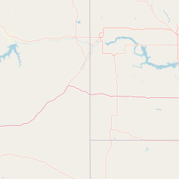          Leaflet | © OpenStreetMap The distance between cities calculated based on their latitudes and longitudes. This is also called distance as the crow flies. Bird flight distance is calculated by drawing a straight line between two point coordinates. The length of this drawn line will give the shortest distance value. This distance may be very much different from the actual travel distance. Salt Lake City GPS Coordinates: Latitude: N 40° 45' 38.8'' Longitude: W 111° 53' 27.8'' Helena GPS Coordinates: Latitude: N 46° 35' 20.9'' Longitude: W 112° 2' 20.8'' Salt Lake City Map, Where is Salt Lake City located? Helena Map, Where is Helena located? |
Popular Searches from Salt Lake City
- Salt Lake City to Key West flight time, duration and distance
- Salt Lake City to Miami flight time, duration and distance
- Salt Lake City to Lihue flight time, duration and distance
- Salt Lake City to Sacramento flight time, duration and distance
- Salt Lake City to Frankfurt am Main flight time, duration and distance
- Salt Lake City to Anchorage flight time, duration and distance
- Salt Lake City to Redmond flight time, duration and distance
- Salt Lake City to Tokyo flight time, duration and distance
- Salt Lake City to Jackson flight time, duration and distance
- Salt Lake City to Melbourne flight time, duration and distance
- Salt Lake City to New Orleans flight time, duration and distance
- Salt Lake City to Tampa flight time, duration and distance
- Salt Lake City to Hurricane flight time, duration and distance
- Salt Lake City to Cleveland flight time, duration and distance
- Salt Lake City to Big Sky flight time, duration and distance
- Salt Lake City to Cleveland flight time, duration and distance
- Salt Lake City to Warsaw flight time, duration and distance
- Salt Lake City to Warsaw flight time, duration and distance
Popular Searches from Helena
- Helena to Nashville flight time, duration and distance
- Helena to Nashville flight time, duration and distance
- Helena to Zihuatanejo flight time, duration and distance
- Helena to Long Beach flight time, duration and distance
- Helena to Honolulu flight time, duration and distance
- Helena to Kuwait City flight time, duration and distance
- Helena to Silver Spring flight time, duration and distance
- Helena to Denver flight time, duration and distance
- Helena to Pasco flight time, duration and distance
- Helena to Des Moines flight time, duration and distance