New York to Venezuela Flight Time, Distance, Route Map
Flight time from New York, United States to Venezuela, Venezuela is 4 hours 14 minutes under avarage conditions. Our flight time calculator assumes an average flight speed for a commercial airliner of 500 mph, which is equivalent to 805 km/hr or 434 knots. Actual flight times may vary depending on aircraft type, cruise speed, routing, weather conditions, passenger load, and other factors.
What is the Flight Distance Between New York and Venezuela?
The flight distance from New York (United States) to Venezuela (Venezuela) is 2120 miles. This is equivalent to 3412 kilometers or 1841 nautical miles. The calculated distance (air line) is the straight line distance or direct flight distance between cities. The nearest airport to New York, is La Guardia Airport (LGA) and the nearest airport to Venezuela, is La Chinita Airport (MAR).
New York - Venezuela Timezones & Time Difference
Current local time in New York is 2025-08-17, 17:47:58 EDT
Current local time in Venezuela is 2025-08-17, 17:47:58 -04.
Time difference between New York (United States) and Venezuela (Venezuela) is 0 Hours.
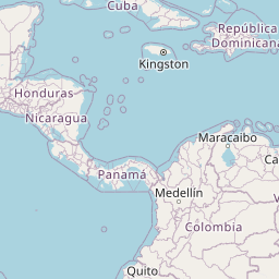
New York to Venezuela Flight Route Map
Flight map from New York, United States to Venezuela, Venezuela is given below.Click the map to view New York to Venezuela nonstop flight path and travel direction.
             Leaflet | © OpenStreetMap The distance between cities calculated based on their latitudes and longitudes. This is also called distance as the crow flies. Bird flight distance is calculated by drawing a straight line between two point coordinates. The length of this drawn line will give the shortest distance value. This distance may be very much different from the actual travel distance. New York GPS Coordinates: Latitude: N 40° 42' 46'' Longitude: W 74° 0' 21.4'' Venezuela GPS Coordinates: Latitude: N 10° 7' 48.5'' Longitude: W 71° 12' 58.1'' New York Map, Where is New York located? Venezuela Map, Where is Venezuela located? |
Popular Searches from New York
- New York to Glasgow flight time, duration and distance
- New York to Edinburgh flight time, duration and distance
- New York to Paris flight time, duration and distance
- New York to Zürich flight time, duration and distance
- New York to Colorado Springs flight time, duration and distance
- New York to Tbilisi flight time, duration and distance
- New York to Los Angeles flight time, duration and distance
- New York to Dublin flight time, duration and distance
- New York to Prague flight time, duration and distance
- New York to Pawnee City flight time, duration and distance
- New York to Boston flight time, duration and distance
- New York to Tokyo flight time, duration and distance
- New York to Hawaiian Paradise Park flight time, duration and distance
- New York to Kraków flight time, duration and distance
- New York to Portugalete flight time, duration and distance
- New York to Louisville flight time, duration and distance
- New York to Hawaii Volcanoes National Park flight time, duration and distance
- New York to London flight time, duration and distance