Nadi to Tarawa Flight Time, Distance, Route Map
Flight time from Nadi, Fiji to Tarawa, Kiribati is 2 hours 43 minutes under avarage conditions. Our flight time calculator assumes an average flight speed for a commercial airliner of 500 mph, which is equivalent to 805 km/hr or 434 knots. Actual flight times may vary depending on aircraft type, cruise speed, routing, weather conditions, passenger load, and other factors.
What is the Flight Distance Between Nadi and Tarawa?
The flight distance from Nadi (Fiji) to Tarawa (Kiribati) is 1363 miles. This is equivalent to 2194 kilometers or 1184 nautical miles. The calculated distance (air line) is the straight line distance or direct flight distance between cities. The nearest airport to Nadi, is Nadi International Airport (NAN) and the nearest airport to Tarawa, is Bonriki Airport (TRW).
Nadi - Tarawa Timezones & Time Difference
Current local time in Nadi is 2025-07-27, 18:23:18 +12
Current local time in Tarawa is 2025-07-27, 18:23:18 +12.
Time difference between Nadi (Fiji) and Tarawa (Kiribati) is 0 Hours.
Nadi to Tarawa Flight Route Map
Flight map from Nadi, Fiji to Tarawa, Kiribati is given below.Click the map to view Nadi to Tarawa nonstop flight path and travel direction.
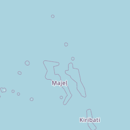     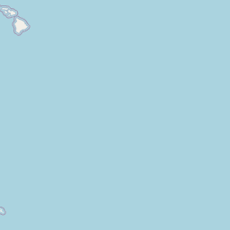              Leaflet | © OpenStreetMap The distance between cities calculated based on their latitudes and longitudes. This is also called distance as the crow flies. Bird flight distance is calculated by drawing a straight line between two point coordinates. The length of this drawn line will give the shortest distance value. This distance may be very much different from the actual travel distance. Nadi GPS Coordinates: Latitude: S 17° 46' 35.5'' Longitude: E 177° 26' 8.2'' Tarawa GPS Coordinates: Latitude: N 1° 27' 6.5'' Longitude: E 172° 58' 18'' Nadi Map, Where is Nadi located? Tarawa Map, Where is Tarawa located? |
Popular Searches from Nadi
- Nadi to Shanghai flight time, duration and distance
- Nadi to Bogotá flight time, duration and distance
- Nadi to Easter Island flight time, duration and distance
- Nadi to Melbourne flight time, duration and distance
- Nadi to Sydney flight time, duration and distance
- Nadi to Nairobi flight time, duration and distance
- Nadi to Cairns flight time, duration and distance
- Nadi to Krong Siem Reap flight time, duration and distance
- Nadi to Lima flight time, duration and distance
- Nadi to Argentina flight time, duration and distance
- Nadi to Sydney flight time, duration and distance
- Nadi to Los Angeles flight time, duration and distance
- Nadi to Port Vila flight time, duration and distance
- Nadi to Funafuti flight time, duration and distance
- Nadi to Peoria flight time, duration and distance
- Nadi to Sydney flight time, duration and distance
- Nadi to Santiago flight time, duration and distance
- Nadi to São Paulo flight time, duration and distance
- Nadi to Los Angeles flight time, duration and distance