Havana to Guadalajara Flight Time, Distance, Route Map
Flight time from Havana, Cuba to Guadalajara, Mexico is 2 hours 42 minutes under avarage conditions. Our flight time calculator assumes an average flight speed for a commercial airliner of 500 mph, which is equivalent to 805 km/hr or 434 knots. Actual flight times may vary depending on aircraft type, cruise speed, routing, weather conditions, passenger load, and other factors.
What is the Flight Distance Between Havana and Guadalajara?
The flight distance from Havana (Cuba) to Guadalajara (Mexico) is 1355 miles. This is equivalent to 2181 kilometers or 1177 nautical miles. The calculated distance (air line) is the straight line distance or direct flight distance between cities. The nearest airport to Havana, is Jose Marti International Airport (HAV) and the nearest airport to Guadalajara, is Miguel Hidal Airport (GDL).
Havana - Guadalajara Timezones & Time Difference
Current local time in Havana is 2025-08-22, 19:26:02 CDT
Current local time in Guadalajara is 2025-08-22, 17:26:02 CST.
Time difference between Havana (Cuba) and Guadalajara (Mexico) is 2 Hours.
Guadalajara time is 2 Hours behind Havana.
Havana to Guadalajara Flight Route Map
Flight map from Havana, Cuba to Guadalajara, Mexico is given below.Click the map to view Havana to Guadalajara nonstop flight path and travel direction.
       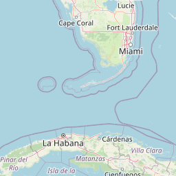 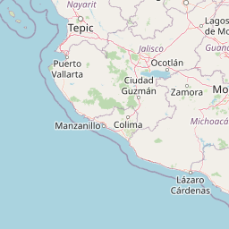   Leaflet | © OpenStreetMap The distance between cities calculated based on their latitudes and longitudes. This is also called distance as the crow flies. Bird flight distance is calculated by drawing a straight line between two point coordinates. The length of this drawn line will give the shortest distance value. This distance may be very much different from the actual travel distance. Havana GPS Coordinates: Latitude: N 23° 6' 48.9'' Longitude: W 82° 21' 59.7'' Guadalajara GPS Coordinates: Latitude: N 20° 39' 34.9'' Longitude: W 103° 20' 58.6'' Havana Map, Where is Havana located? Guadalajara Map, Where is Guadalajara located? |
Popular Searches from Havana
- Havana to Caracas flight time, duration and distance
- Havana to Tampa flight time, duration and distance
- Havana to Nassau flight time, duration and distance
- Havana to Bogotá flight time, duration and distance
- Havana to Boston flight time, duration and distance
- Havana to Toronto flight time, duration and distance
- Havana to Mexico City flight time, duration and distance
- Havana to Cancún flight time, duration and distance
- Havana to Cancún flight time, duration and distance
- Havana to Rio de Janeiro flight time, duration and distance
- Havana to Montevideo flight time, duration and distance
- Havana to Merida flight time, duration and distance
- Havana to Moscow flight time, duration and distance
- Havana to New York flight time, duration and distance
- Havana to Washington flight time, duration and distance
- Havana to Miami flight time, duration and distance
- Havana to Miami flight time, duration and distance
- Havana to Dubai flight time, duration and distance
- Havana to Freeport flight time, duration and distance
- Havana to Miami flight time, duration and distance
Popular Searches from Guadalajara
- Guadalajara to Calgary flight time, duration and distance
- Guadalajara to Toronto flight time, duration and distance
- Guadalajara to Mexico City flight time, duration and distance
- Guadalajara to Mexico City flight time, duration and distance
- Guadalajara to Dallas flight time, duration and distance
- Guadalajara to Orlando flight time, duration and distance
- Guadalajara to Vancouver flight time, duration and distance
- Guadalajara to Panama City flight time, duration and distance
- Guadalajara to Puerto Vallarta flight time, duration and distance
- Guadalajara to Rio de Janeiro flight time, duration and distance
- Guadalajara to Chicago flight time, duration and distance
- Guadalajara to Houston flight time, duration and distance
- Guadalajara to London flight time, duration and distance
- Guadalajara to London flight time, duration and distance
- Guadalajara to Melbourne flight time, duration and distance
- Guadalajara to Vancouver flight time, duration and distance