Calgary to Scottsdale Flight Time, Distance, Route Map
Flight time from Calgary, Canada to Scottsdale, United States is 2 hours 26 minutes under avarage conditions. Our flight time calculator assumes an average flight speed for a commercial airliner of 500 mph, which is equivalent to 805 km/hr or 434 knots. Actual flight times may vary depending on aircraft type, cruise speed, routing, weather conditions, passenger load, and other factors.
What is the Flight Distance Between Calgary and Scottsdale?
The flight distance from Calgary (Canada) to Scottsdale (United States) is 1218 miles. This is equivalent to 1960 kilometers or 1058 nautical miles. The calculated distance (air line) is the straight line distance or direct flight distance between cities. The nearest airport to Calgary, is Calgary International Airport (YYC) and the nearest airport to Scottsdale, is Scottsdale Municipal Airport (SCF).
Calgary - Scottsdale Timezones & Time Difference
Current local time in Calgary is 2025-08-11, 02:18:03 MST
Current local time in Scottsdale is 2025-08-11, 02:18:03 MST.
Time difference between Calgary (Canada) and Scottsdale (United States) is 0 Hours.
Calgary to Scottsdale Flight Route Map
Flight map from Calgary, Canada to Scottsdale, United States is given below.Click the map to view Calgary to Scottsdale nonstop flight path and travel direction.
        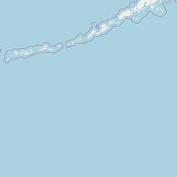     Leaflet | © OpenStreetMap The distance between cities calculated based on their latitudes and longitudes. This is also called distance as the crow flies. Bird flight distance is calculated by drawing a straight line between two point coordinates. The length of this drawn line will give the shortest distance value. This distance may be very much different from the actual travel distance. Calgary GPS Coordinates: Latitude: N 51° 2' 55'' Longitude: W 114° 4' 15'' Scottsdale GPS Coordinates: Latitude: N 33° 29' 39'' Longitude: W 111° 55' 33.8'' Calgary Map, Where is Calgary located? Scottsdale Map, Where is Scottsdale located? |
Popular Searches from Calgary
- Calgary to Toronto flight time, duration and distance
- Calgary to Guadalajara flight time, duration and distance
- Calgary to Dubai flight time, duration and distance
- Calgary to Singapore flight time, duration and distance
- Calgary to Moscow flight time, duration and distance
- Calgary to Toronto flight time, duration and distance
- Calgary to São Paulo flight time, duration and distance
- Calgary to Victoria flight time, duration and distance
- Calgary to Kelowna flight time, duration and distance
- Calgary to Dubai flight time, duration and distance
- Calgary to Singapore flight time, duration and distance
- Calgary to Sydney flight time, duration and distance
- Calgary to Frankfurt am Main flight time, duration and distance
- Calgary to Regina flight time, duration and distance
- Calgary to Edmonton flight time, duration and distance
- Calgary to Centralia flight time, duration and distance
- Calgary to Montreal flight time, duration and distance
Popular Searches from Scottsdale
- Scottsdale to Nashville flight time, duration and distance
- Scottsdale to Kahului flight time, duration and distance
- Scottsdale to Waukesha flight time, duration and distance
- Scottsdale to Santa Ana flight time, duration and distance
- Scottsdale to Las Vegas flight time, duration and distance
- Scottsdale to Knoxville flight time, duration and distance
- Scottsdale to San Luis Obispo flight time, duration and distance
- Scottsdale to Roswell flight time, duration and distance
- Scottsdale to Lubbock flight time, duration and distance
- Scottsdale to Dallas flight time, duration and distance
- Scottsdale to Napa flight time, duration and distance
- Scottsdale to Santa Ana flight time, duration and distance
- Scottsdale to Dayton flight time, duration and distance
- Scottsdale to Dayton flight time, duration and distance
- Scottsdale to Belgrade flight time, duration and distance
- Scottsdale to Loreto flight time, duration and distance
- Scottsdale to Lahaina flight time, duration and distance
- Scottsdale to London flight time, duration and distance
- Scottsdale to Dubai flight time, duration and distance
- Scottsdale to Sydney flight time, duration and distance