Abuja to Tel Aviv-Yafo Flight Time, Distance, Route Map
Flight time from Abuja, Nigeria to Tel Aviv-Yafo, Israel is 4 hours 44 minutes under avarage conditions. Our flight time calculator assumes an average flight speed for a commercial airliner of 500 mph, which is equivalent to 805 km/hr or 434 knots. Actual flight times may vary depending on aircraft type, cruise speed, routing, weather conditions, passenger load, and other factors.
What is the Flight Distance Between Abuja and Tel Aviv-Yafo?
The flight distance from Abuja (Nigeria) to Tel Aviv-Yafo (Israel) is 2366 miles. This is equivalent to 3808 kilometers or 2055 nautical miles. The calculated distance (air line) is the straight line distance or direct flight distance between cities. The nearest airport to Abuja, is International Airport (ABV) and the nearest airport to Tel Aviv-Yafo, is Ben Gurion International Airport (TLV).
Abuja - Tel Aviv-Yafo Timezones & Time Difference
Current local time in Abuja is 2025-08-24, 03:32:57 WAT
Current local time in Tel Aviv-Yafo is 2025-08-24, 05:32:57 IDT.
Time difference between Abuja (Nigeria) and Tel Aviv-Yafo (Israel) is 2 Hours.
Tel Aviv-Yafo time is 2 Hours ahead of Abuja.
Abuja to Tel Aviv-Yafo Flight Route Map
Flight map from Abuja, Nigeria to Tel Aviv-Yafo, Israel is given below.Click the map to view Abuja to Tel Aviv-Yafo nonstop flight path and travel direction.
  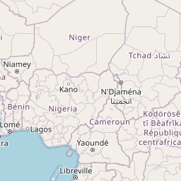 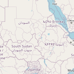        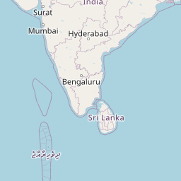  Leaflet | © OpenStreetMap The distance between cities calculated based on their latitudes and longitudes. This is also called distance as the crow flies. Bird flight distance is calculated by drawing a straight line between two point coordinates. The length of this drawn line will give the shortest distance value. This distance may be very much different from the actual travel distance. Abuja GPS Coordinates: Latitude: N 9° 4' 35.3'' Longitude: E 7° 23' 54.9'' Tel Aviv-Yafo GPS Coordinates: Latitude: N 32° 5' 7.1'' Longitude: E 34° 46' 54.4'' Abuja Map, Where is Abuja located? Tel Aviv-Yafo Map, Where is Tel Aviv-Yafo located? |
Popular Searches from Abuja
- Abuja to Cape Town flight time, duration and distance
- Abuja to Amman flight time, duration and distance
- Abuja to Lagos flight time, duration and distance
- Abuja to Rio de Janeiro flight time, duration and distance
- Abuja to Tehran flight time, duration and distance
- Abuja to İstanbul flight time, duration and distance
- Abuja to Dubai flight time, duration and distance
- Abuja to Greenville flight time, duration and distance
- Abuja to Akwa Ibami flight time, duration and distance
- Abuja to Kigali flight time, duration and distance
- Abuja to Addis Ababa flight time, duration and distance
- Abuja to Kano flight time, duration and distance
- Abuja to Amsterdam flight time, duration and distance
- Abuja to Lagos flight time, duration and distance
- Abuja to Paris flight time, duration and distance
- Abuja to Christchurch flight time, duration and distance
- Abuja to Birmingham flight time, duration and distance
- Abuja to London flight time, duration and distance
- Abuja to Melbourne flight time, duration and distance
- Abuja to Texas City flight time, duration and distance
Popular Searches from Tel Aviv-Yafo
- Tel Aviv-Yafo to Tokyo flight time, duration and distance
- Tel Aviv-Yafo to Manama flight time, duration and distance
- Tel Aviv-Yafo to Buri flight time, duration and distance
- Tel Aviv-Yafo to Mumbai flight time, duration and distance
- Tel Aviv-Yafo to Abu Dhabi flight time, duration and distance
- Tel Aviv-Yafo to New York flight time, duration and distance
- Tel Aviv-Yafo to Sydney flight time, duration and distance
- Tel Aviv-Yafo to Tehran flight time, duration and distance
- Tel Aviv-Yafo to Tehran flight time, duration and distance
- Tel Aviv-Yafo to Bucharest flight time, duration and distance
- Tel Aviv-Yafo to Larnaca flight time, duration and distance
- Tel Aviv-Yafo to London flight time, duration and distance
- Tel Aviv-Yafo to Palermo flight time, duration and distance
- Tel Aviv-Yafo to Rome flight time, duration and distance
- Tel Aviv-Yafo to Milan flight time, duration and distance
- Tel Aviv-Yafo to Los Angeles flight time, duration and distance
- Tel Aviv-Yafo to Los Angeles flight time, duration and distance
- Tel Aviv-Yafo to Miami flight time, duration and distance
- Tel Aviv-Yafo to Helsinki flight time, duration and distance