Washington to Santo Domingo Flight Time, Distance, Route Map
Flight time from Washington, United States to Santo Domingo, Dominican Republic is 2 hours 57 minutes under avarage conditions. Our flight time calculator assumes an average flight speed for a commercial airliner of 500 mph, which is equivalent to 805 km/hr or 434 knots. Actual flight times may vary depending on aircraft type, cruise speed, routing, weather conditions, passenger load, and other factors.
What is the Flight Distance Between Washington and Santo Domingo?
The flight distance from Washington (United States) to Santo Domingo (Dominican Republic) is 1474 miles. This is equivalent to 2372 kilometers or 1280 nautical miles. The calculated distance (air line) is the straight line distance or direct flight distance between cities. The nearest airport to Washington, is Ronald Reagan National Airport (DCA) and the nearest airport to Santo Domingo, is La Isabela International Airport (JBQ).
Washington - Santo Domingo Timezones & Time Difference
Current local time in Washington is 2025-08-03, 04:32:54 EDT
Current local time in Santo Domingo is 2025-08-03, 04:32:54 AST.
Time difference between Washington (United States) and Santo Domingo (Dominican Republic) is 0 Hours.
Washington to Santo Domingo Flight Route Map
Flight map from Washington, United States to Santo Domingo, Dominican Republic is given below.Click the map to view Washington to Santo Domingo nonstop flight path and travel direction.
 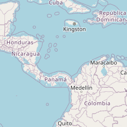                  Leaflet | © OpenStreetMap The distance between cities calculated based on their latitudes and longitudes. This is also called distance as the crow flies. Bird flight distance is calculated by drawing a straight line between two point coordinates. The length of this drawn line will give the shortest distance value. This distance may be very much different from the actual travel distance. Washington GPS Coordinates: Latitude: N 38° 54' 25.9'' Longitude: W 77° 2' 12.7'' Santo Domingo GPS Coordinates: Latitude: N 18° 29' 9.8'' Longitude: W 69° 55' 52.4'' Washington Map, Where is Washington located? Santo Domingo Map, Where is Santo Domingo located? |
Popular Searches from Washington
- Washington to Charlotte flight time, duration and distance
- Washington to Charleston flight time, duration and distance
- Washington to Honolulu flight time, duration and distance
- Washington to Dubai flight time, duration and distance
- Washington to Reykjavík flight time, duration and distance
- Washington to Reykjavík flight time, duration and distance
- Washington to Des Moines flight time, duration and distance
- Washington to Anchorage flight time, duration and distance
- Washington to San Juan flight time, duration and distance
- Washington to Amsterdam flight time, duration and distance
- Washington to Seattle flight time, duration and distance
- Washington to Tehran flight time, duration and distance
- Washington to Mumbai flight time, duration and distance
- Washington to Honolulu flight time, duration and distance
- Washington to Honolulu flight time, duration and distance
- Washington to Sydney flight time, duration and distance
- Washington to Melbourne flight time, duration and distance
- Washington to Auckland flight time, duration and distance
- Washington to Paris flight time, duration and distance
Popular Searches from Santo Domingo
- Santo Domingo to Accra flight time, duration and distance
- Santo Domingo to Miami flight time, duration and distance
- Santo Domingo to Miami flight time, duration and distance
- Santo Domingo to Heroica Veracruz flight time, duration and distance
- Santo Domingo to Merida flight time, duration and distance
- Santo Domingo to Puebla flight time, duration and distance
- Santo Domingo to Caracas flight time, duration and distance
- Santo Domingo to Boston flight time, duration and distance
- Santo Domingo to Boston flight time, duration and distance
- Santo Domingo to Basseterre flight time, duration and distance
- Santo Domingo to Kingston flight time, duration and distance
- Santo Domingo to Montréal-Est flight time, duration and distance
- Santo Domingo to Toronto flight time, duration and distance
- Santo Domingo to New York flight time, duration and distance
- Santo Domingo to Charleston flight time, duration and distance
- Santo Domingo to Charleston flight time, duration and distance
- Santo Domingo to Charleston flight time, duration and distance
- Santo Domingo to Fayetteville flight time, duration and distance